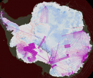
ICECAP 2017-18 FIELD SEASON
Solving Antarctica’s melting mystery
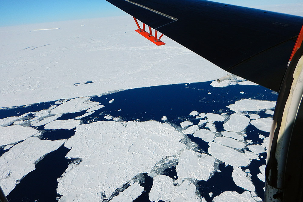
Australian researchers are getting ready for the next season of ICECAP, the groundbreaking international science partnership transforming our understanding of Antarctica’s shrinking ice sheet.
The ice shelves surrounding Antarctica have been thinning in response to climate change for at least two decades, and yet we still know remarkably little about the fundamental processes driving this change.
This is partly due to the mind-boggling complexity of the physical processes that bring swirling masses of heat energy from the oceans and atmosphere into contact with the Antarctic ice sheet.
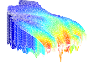
An ice sheet model of part of Aurora Basin, which feeds Totten Glacier (Felicity Graham)
Antarctica remains one of the most data-scarce regions of the planet, despite the urgent need for high quality data for setting the so-called ‘boundary conditions’ required to kickstart and constrain sea level model calculations.
The job of shading in the gaps in our knowledge of the Antarctic cryosphere has therefore become one of the top priorities for scientists studying sea level rise – and it’s a challenge that the international team behind ICECAP is tackling head on.
What is ICECAP?
Dr Lenneke Jong from the Antarctic Climate and Ecosystems Cooperative Research Centre will this year lead the Australian contingent of ICECAP, which stands for International Collaboration for Exploration of the Cryosphere through Aerogeophysical Profiling .
The international consortium brings together the expertise of scientists from the United States, United Kingdom, France, China and Australia, to investigate how and why the ice sheet and ice shelves of East Antarctica are evolving.
Dr Jong’s team combines research talent and technical expertise from multiple agencies linked to the Australian Antarctic Program, including the Australian Antarctic Division and the University of Tasmania’s Institute for Marine and Antarctic Studies.
In its eight seasons of operation, ICECAP has established itself as one of the most important survey projects of the East Antarctic ice sheet arguably since the time of Mawson, Scott and Amundsen.
Before the launch of ICECAP in the International Polar Year 2008, we knew very little about the underlying topography of the bedrock beneath the East Antarctic ice sheet, or how the ice sheets shifted over time.
Australia’s participation in ICECAP helped to enable detailed airborne geophysical survey of large areas of East Antarctica for the first time, filling in a vast blank on the map of Australia’s Antarctic territory.
To gather the enormous quantities of data required for the project, a reconditioned WWII-era DC-3 airframe is fitted with modern-day radar imaging equipment, magnetometers, gravimeters, lasers and GPS equipment.
The view from the ICECAP aerial platform, showing the wing-mounted radar antenna.
Each ICECAP flight covers in a few hours what once took an entire field season or longer. In eight seasons of flying out of Casey Station, the aircraft have covered more than a quarter of a million kilometres of survey, producing terabytes of data.
An ice penetrating radar system produces a massive volume of data, imaging the bedrock below and building a highly detailed picture of the internal layers in the ice sheet at a resolution of only a couple of metres.
The result is the first accurate map of East Antarctica’s topography in three dimensions– stretching from deep inside the ice sheet and out to the surrounding ocean.
Science Objectives for 2017-18
This year’s field season will see the ICECAP team focus special attention on the critical ocean-ice threshold at a number of locations near of Casey Station, including the Totten Glacier, the Moscow University Ice Shelf and the Shackleton Ice Shelf.
Their long term scientific goal is to understand the ice shelves’ stability and their response to changes in environmental conditions, such as air and ocean temperatures and ocean currents.
In addition to the ice penetrating radar, the team has recently added a new tool to their data gathering arsenal that enables them to measure changes in ocean properties.
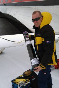
ICECAP chief investigator, Dr Jason Roberts, with an AXBT.
The devices, about the size of a large postage tube, are able to measure water depth and properties including temperature, and relay the information back via satellite.
Their mission will be to looking for ocean pathways where warm water might be getting in beneath the glaciers.
The instruments are jettisoned from the aircraft over the target location and are carried to the ocean surface by a small parachute.
At the surface, a probe is released and measures temperature through the water column, relaying the information via a freely unwinding wire to a radio transmitter at the ocean surface.
The devices are among the most efficient and cost-effective means of measuring large areas of the ocean that would usually be inaccessible to ships due to sea ice or ice bergs.
The scientists hope that this information will enable us to understand the type of ocean conditions associated with glacial melting – information that is essential for projecting how the entire ice sheet will continue to respond to future climate change.
[dropshadowbox align=”none” effect=”lifted-both” width=”auto” height=”” background_color=”#ececec” border_width=”1″ border_color=”#dddddd” rounded_corners=”false” inside_shadow=”false” ]
Mapping Antarctica: A Brief History
There have been a great many Antarctic mapping projects since humans first arrived on the frozen continent. The earliest scientific charts began appearing in the early nineteenth century, soon after Russian expeditioners Fabian Gottlieb von Bellingshausen and Mikhail Lazarev first caught sight of the ice-edge in 1820.
The continent, however, remained largely neglected for the rest of the 19th century because of its hostile environment and isolation. In 1895, the first confirmed landing was conducted by a team of Norwegians. Between then and the arrival of the satellite era in the 1960s, the stubborn geography and bitter climate of Antarctica made it slow going for cartographers. The advent of satellite remote sensing was a step-change in our ability to map changes to the distribution of ice at the edges of the ice sheet, including iceberg calvings and changes in sea ice distribution.
While later generations of satellites were able to reliably measure surface elevation of the ice, the crucial breakthrough for ICECAP is its ability to map the ice sheet in the crucial third dimension. Not much longer than a decade ago, the best and most reliable means of measuring the thickness of the ice sheet in a given location was to drill down until you hit bedrock. When the ice can be several kilometers thick in many parts of the continent, this approach is slow going.
The data generated by ICECAP has begun to transform our understanding of the history and possible future of the East Antarctic ice sheet. One of the biggest surprises from ICECAP was the discovery of plunging glacial valleys buried beneath the ice hundreds kilometres from the edge of the ice sheet. Glacial valleys are not known to form inland but rather at the edges of the ice sheet where it flows more quickly. The findings, published in a landmark paper in the journal Nature, suggest that the formations are relics of the growth of the Antarctic ice sheet over the 20-million-year period beginning some 34-million years ago.
Another finding which has overturned past thinking has been the discovery of vast regions where the ice rests on bedrock that is far below sea level. The East Antarctic ice sheet was previously thought to rest largely on elevated mountainous terrain. This discovery leads to the possibility that this ice could be more vulnerable to future loss as warming oceans force the ice to retreat.
The data produced by this project will continue to be the cornerstone of some of the most important efforts to understand the future fate of the Antarctic ice sheet under climate change. The final result will be a more reliable forecasting system for looking decades, and possibly hundreds of years, into the future at the likely impacts of a warming climate on the East Antarctic ice sheet. [/dropshadowbox]

